Preskočite na glavni sadržaj
Traži
Prijava
Prijava
A
A
HR
EN
NIPP
Općenito
Tijela NIPP-a
Subjekti NIPP-a
Teme NIPP-a
Nacionalna kontaktna točka
INSPIRE
INSPIRE
Vremenski okvir uspostave INSPIRE-a
Dokumenti
Zakonski okvir
Dokumenti NIPP-a
Dokumenti INSPIRE-a
Radni dokumenti
Arhiva
Projekti
Jačanje kapaciteta za uspostavu NIPP-a
Povećanje dostupnosti prostornih podataka NIPP-a putem e-usluga
Dani IPP-a 2026.
Dani IPP-a 2026.
Program konferencije
Važni datumi
Događanja
Novosti
NIPP skupovi
NIPP radionice
Baza znanja
Često postavljena pitanja
Publikacije
Pojmovnik
Akronimi i kratice
Poveznice
Metapodaci
Kontakt
Prostorni podaci Republike Hrvatske dostupni na klik miša!
Geoportal NIPP-a
GeoHrvatska
Novosti
29.05.2026.
Dani infrastruktura prostornih podataka 2026. održani u Šibeniku
Dana 27. i 28. svibnja 2026. uspješno su održani Dani IPP-a 2026. u organizaciji Državne geodetske uprave.
25.05.2026.
Zatvorene prijave za konferenciju „Dani IPP-a 2026.“
Prijave za sudjelovanje na konferenciji „Dani IPP-a 2026.“ su zatvorene zbog popunjenja kapaciteta.
19.05.2026.
Objavljen program konferencije Dani IPP-a 2026.
Program konferencije Dani IPP-a 2026.
objavljen je na
mrežnim stranicama posvećenima konferenciji
te je dostupan pregled planiranih izlaganja, tema i sudionika. Konferencija se održava 28. svibnja 2026. godine u Mediteranskom gradu Amadria Parka, Šibenik.
12.05.2026.
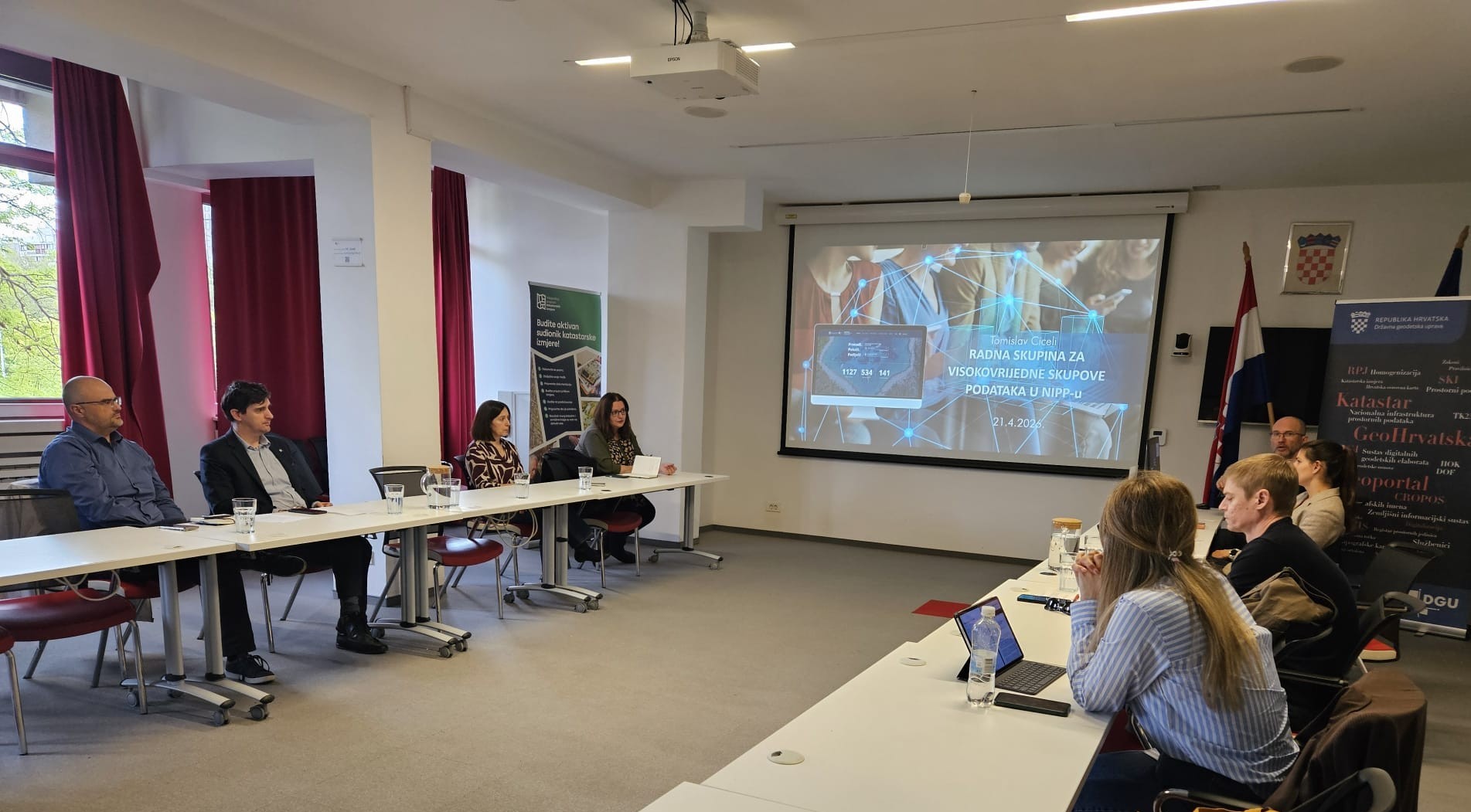
Održan sastanak Radne skupine za visokovrijedne skupove prostornih podataka u NIPP-u
Dana 21. travnja 2026. održan je prvi sastanak Radne skupine za visokovrijedne skupove prostornih podataka.
Više
Izdvojeno
Što je NIPP?
Vremenski okvir
Registri NIPP-a
Metapodaci
NIPP i INSPIRE
Pogledaj video
Najčitanije
Zakon o NIPP-u (NN 56/2013)
INSPIRE direktiva (Direktiva 2007/2/EZ)
Registar subjekata NIPP-a (predložak)
Registar izvora prostornih podataka NIPP-a (predložak)
Specifikacija metapodataka v.3.0