
10th NSDI and INSPIRE day within "SDI Days 2018" conference
SDI Days 2018 and 14th International Conference on Geoinformation and Cartography were successfully held at the Faculty of Geodesy University of Zagreb on 27th and 28th September 2018. The conference was jointly organized by the State Geodetic Administration, the Croatian Cartographic Society and the Faculty of Geodesy.The conference was held under the auspices of the President of the Republic of Croatia, Kolinda Grabar-Kitarović. It was opened by an envoy on behalf of the Office of the President, Counsel of Defense and National Security, Mr. Vlado Galić who in his opening speech emphasized that, due to its core value, all economic branches and scientific institutions as well as individuals have need for spatial data and that management, exchange and use of spatial data present one of the basis for the development of society.
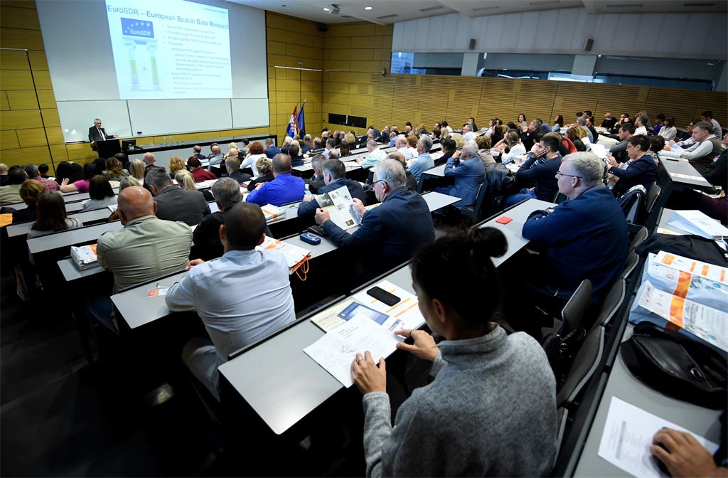
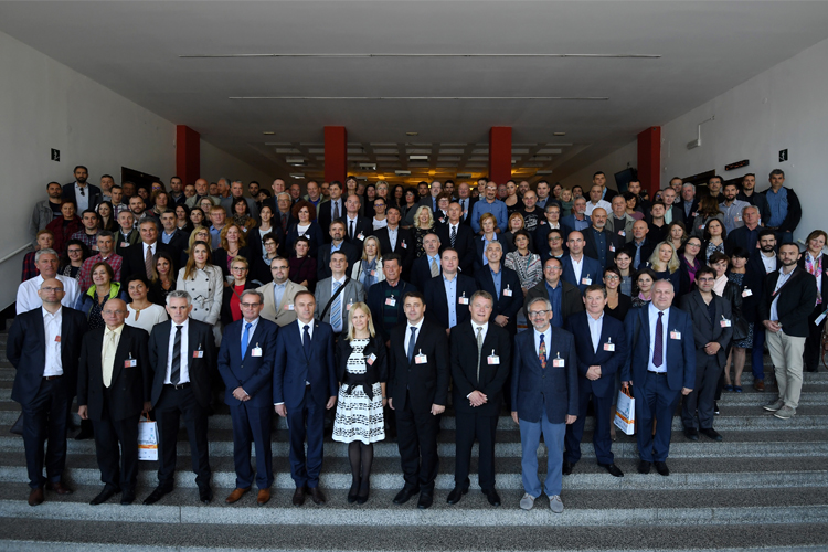
In the introductory part of the conference, welcoming speeches for 250 participants were given by the Head of the Sector for Spatial Data Infrastructure of the State Geodetic Administration, Ljerka Marić, MS.c., President of the Croatian Cartographic Society and President of the Organizing Committee of the Conference prof. emer. Miljenko Lapaine, PhD, Dean of the Faculty of Geodesy prof. Damir Medak, PhD, Secretary General of the International Cartographic Association prof. Laszlo Zentai, PhD, and Director of State Geodetic Administration Damir Šantek, PhD.
After the opening part, a forum was held and moderated by Tomislav Ciceli, M.Sc., Head of the NSDI Division. The participants of the forum were: Ms. Jarmila Pezo, Chairman of the Board IGEA, IN2, Ms. Ljerka Marić, M.Sc., Head of the Spatial Data Infrastructure Sector of the State Geodetic Administration, Mr. Božo Zeba, from the Central State Office for the Development of the Digital Society, Mr. Mladen Majcen from the Agency for Payments in Agriculture, Fisheries and Rural Development, Mr. Vlado Cetl from the Joint Research Center of the European Commission and Mr. Damir Šantek, PhD, director of the State Geodetic Administration.
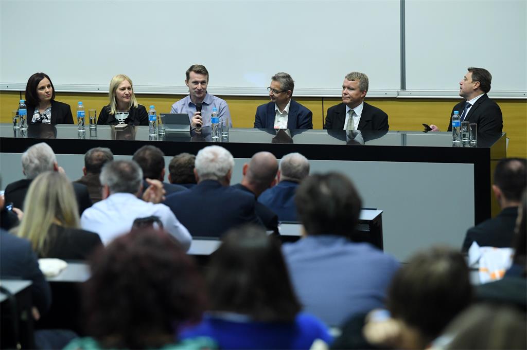
The director of the State Geodetic Administration emphasized the positive steps taken by the State Geodetic Administration in order to fulfill the requirements of the INSPIRE directive and its implementation in the Republic of Croatia. The common conclusion of all participants is that there is certainly room for progress in NSDI, and that by the year 2021, all NSDI stakeholders will have to work hard to implement the INSPIRE Directive, with the emphasis on data harmonization and development of network services.
After the forum, Ms. Ljerka Marić, M.Sc., and prof. Željko Bačić, PhD, from the Faculty of Geodesy received a Certificate of Acknowledgement for contributions to the development of the National Spatial Data Infrastructure in the Republic of Croatia delivered by the Director of the State Geodetic Administration Mr. Damir Šantek, PhD.
The second part of the conference was organized in two lecture sessions where, among other things, we could hear about the annual monitoring of the spatial data reported in the NSDI then was about the core business of the Working Group on Technical Standards and the experience of the BESTSDI project. In the second session, which was interesting for atypical NSDI topics, we could hear some interesting things about the virtual reality and about OpenStreetMap.
The next day, 14th International Conference on Geoinformation and Cartography was held covering topics from the domain of NSDI and geographic names.
The interest in conference is growing steadily year after year, which is an indirect indicator of the recognition of issues related to the establishment and development of SDIs. Thanks to all the lecturers and participants who have helped this year's SDI Days to be interesting, educational and useful.
Conference was co-financed by the European Social Fund.
| PROGRAMME OF 10. NSDI AND INSPIRE DAY | ||
| TIME | AUTHORS AND LECTURE TITLES | FORMAT |
| 10:00–11:00 | Opening | |
| 11:00–12:00 | V. Cetl: INSPIRE trenutni status i buduće aktivnosti P. Kane: EuroSDR in a nutshell |
PDF |
| 12:00–12:30 | Group photo Coffee break |
|
| 12:30–14:00 | FORUM: NSDI; Can we do it better? Participants: B. Zeba, Središnji ured za razvoj digitalnog društva
Dr. sc. D. Šantek, Državna geodetska uprava
Doc. dr. sc. Milan Rezo, predsjednik Vijeća NIPP-a
M. Majcen, Agencija za plaćanja u poljoprivredi, ribarstvu i
ruralnom razvoju Dr. sc. V. Cetl, Zajednički istraživački centar Europske komisije
J. Pezo, IGEA, IN2 grupa
Mr. sc. Lj. Marić, Državna geodetska uprava
|
PDF |
| 14:00–15:00 | Lunch break | |
| I. session | ||
| 15:00–16:00 |
I. Gašparović, mr. sc. T. Rodin, mr. sc. T. Ciceli:
Uspostava NIPP-a u provedbi INSPIRE direktive iz perspektive godišnjeg praćenja D. Racić, T. Pavić, S. Cvitković, M. Škvorc, I. Skender, D. Bračun,
D. Boto, G. Strinić, Z. Luša, I. Gašparović, mr. sc. D. Divjak: Što radi radna skupina za tehničke standarde NIPP-a? Prof. dr. sc. Ž. Bačić, dr. sc. J. Crompvoets,
doc. dr. sc. V. Poslončec Petrić: Komunikacija i edukacija – bitni aspekti izgradnje IPP-a – iskustva BESTSDI projekta Dr. sc. H. Matijević, M. Škvorc: Sustav za upravljanje izradom i
korištenjem OGC usluga |
PDF |
| 16:00–16:15 | Coffee break | |
| II. session | ||
| 16:15–17:00 | S. Marasović, dr. sc. V. Poslončec Petrić, dr. sc. J. Crompvoets: Pilot projekt implementacije webGIS rješenja u grad Sinj M. Turković: Prostorni podaci u proširenoj stvarnosti H. Bogner: OpenStreetMap u upotrebi |
PDF |
| 17:00–17:15 | Closing | |