

On March 7, 2023. the 33rd NSDI workshop organized by the State Geodetic Administration was held.
The State Geodetic Administration, as the National Contact Point, prepared a data harmonization workshop using the FME (Feature Manipulation Engine) software tool. FME is a data integration platform that enables a simpler process of data harmonization using INSPIRE plugins for FME. Data harmonization itself implies ETL (Extract Transform Load) translation from the existing data model to the data model defined by the INSPIRE Directive and accompanying legislation.
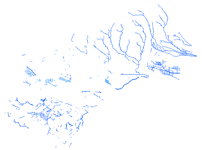
Employees of the National Contact Point, representatives of the companies conterra and Multisoft (which put FME on the market) and representatives of the City of Zagreb participated in the workshop. The City of Zagreb was chosen as the NSDI subject for this workshop due to the high level of preparation of input data. Users could follow in detail each step in the data harmonization process and learn more about the requirements of individual theme in accordance with the data specifications.
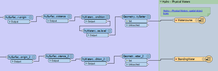
The result of the 33rd NIPP workshop was data harmonized according to INSPIRE in the form of a *.gml file for the INSPIRE themes Hydrography, Transport networks, Land use and Buildings. The final validation of the obtained output (harmonized) data was carried out through the INSPIRE Reference Validator and afterwards errors were corrected. Network view and download services will soon be available for harmonized data.
The FME software solution was procured within the framework of the ERDF project "Increasing the availability of NSDI spatial data through e-services", the goal of which was to increase the availability of spatial data of public authorities, i.e. subjects of NSDI, by developing INSPIRE-compliant network services, and it was implemented by the State Geodetic Administration.
You can find out more about the workshop via the link.