
24th NSDI workshop within the project "Capacity Building for the establishment of the NSDI"
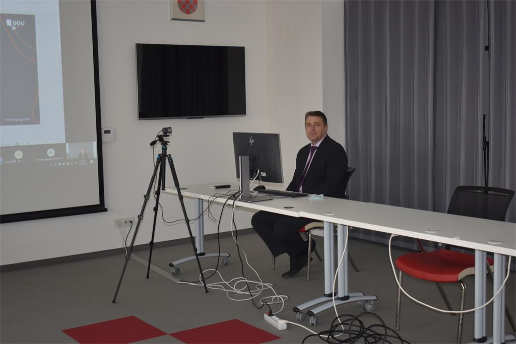
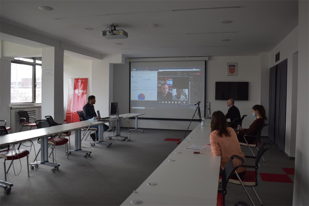
On March 9, the 24th NSDI workshop was held as the first in a new cycle of workshops under the common title "Inclusion of local and regional self-government units in the National Spatial Data Infrastructure (NSDI)" organized by the State Geodetic Administration as the National Contact Point for the NSDI. This cycle of workshops is held within the implementation of the project "Capacity building for the establishment of the NSDI", which is co-financed by the European Social Fund. The workshop was intended for representatives of local and regional self-government units who could not participate in the first cycle of workshops, and was held in the form of a webinar through the Microsoft Teams virtual platform. A total of 46 participants from the Lika-Senj, Brod-Posavina, Međimurje, Krapina-Zagorje, Istria, Koprivnica-Križevci and Dubrovnik-Neretva counties participated, together with the employees of the State Geodetic Administration.
The participants were also welcomed by Ljerka Marić, MsC, Head of the Spatial Data Infrastructure Sector, who greeted all participants and introduced the NSDI Service, responsible for the implementation of the NSDI Act (OG 56/13, 52/18, 50/20). On this occasion, she also stressed the need to make spatial data available in an interoperable way. She also referred to the mentioned project, whose one of the main goals is to include public authorities from the local and regional level in the NSDI. Those present were also greeted by Tomislav Ciceli, MsC, who briefly presented the project and its elements, and the program of the 24th NSDI workshop.

The first lecture entitled “Introduction to NSDI; Anyone can easily find, understand and use spatial data" was held by Tomislav Ciceli, MsC. This lecture was dedicated to the basics and development of the NSDI, and presented the legal, strategic, technical and time frame of its establishment. Special emphasis was placed on understanding the purpose of the NSDI, but also on the obligations it brings. Among other things, the large amount of existing spatial data and the growing development of new spatial data, which need to be made available in order to be useful to citizens, were highlighted.
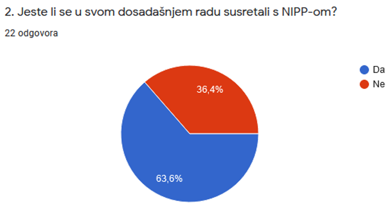
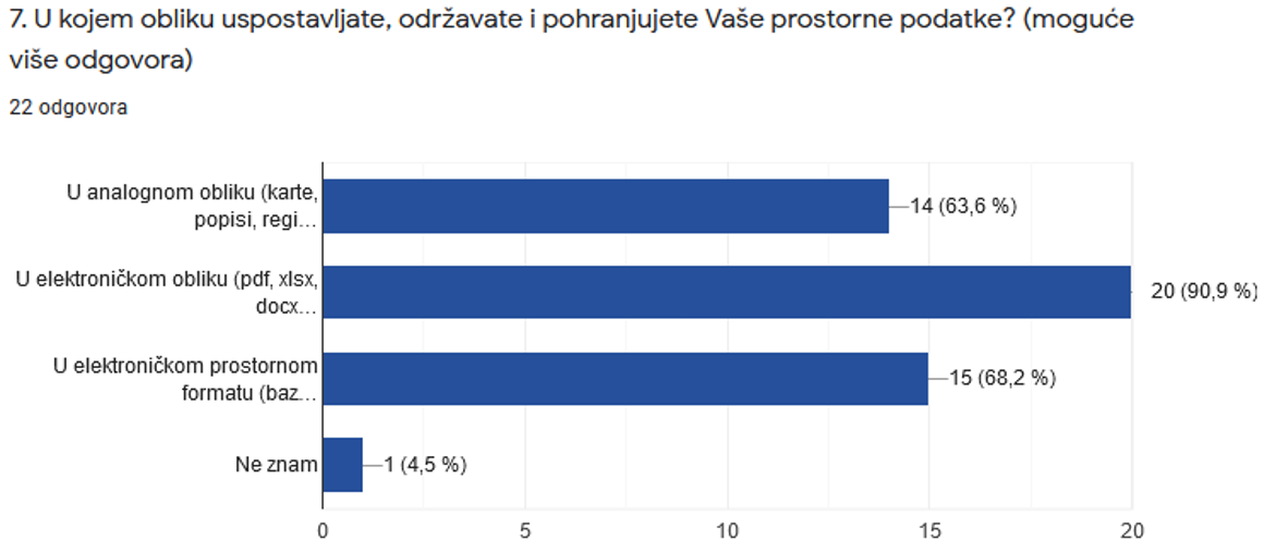
This lecture was followed by interaction with participants, achieved through a short questionnaire whose main purpose was to obtain feedback from participants on knowledge of the NSDI and the spatial data in the competence of local and regional self-government units. The obtained answers showed that a large number of participants have not met with the NSDI so far, which indicates the need to hold this kind of workshops.
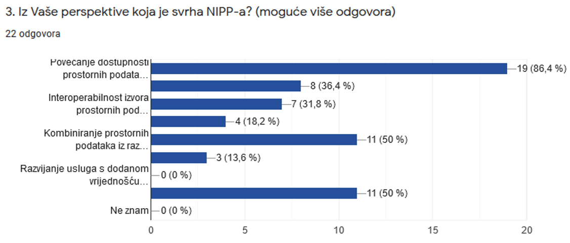
Also, interesting are the answers obtained to the 3rd question from the questionnaire, which show a good understanding of the purpose of NSDI from the user's perspective.
The next was a lecture entitled "NSDI Registers" given by Tanja Rodin, MsC. This lecture describes the first step in the inclusion of subjects in the NSDI, which is achieved through the registration of subjects in the Register of NSDI subjects, and then by registering spatial data sources from their jurisdiction in the Register of NSDI spatial data sources. The forms used on that occasion were presented, which are designed to facilitate and uniform the procedure itself.
The lecture "NSDI Metadata Catalog / NSDI Geoprtal" was given by Iva Gašparović, PhD, who presented through this lecture the final step in joining the NSDI: registration of spatial data sources under the jurisdiction of NSDI subjects on the NSDI Geoportal and their description with metadata on the NSDI Metadata Catalog. NSDI Metadata Specification v.3.0 which is implemented on the NSDI Metadata Catalog and describes the required metadata elements was briefly presented.
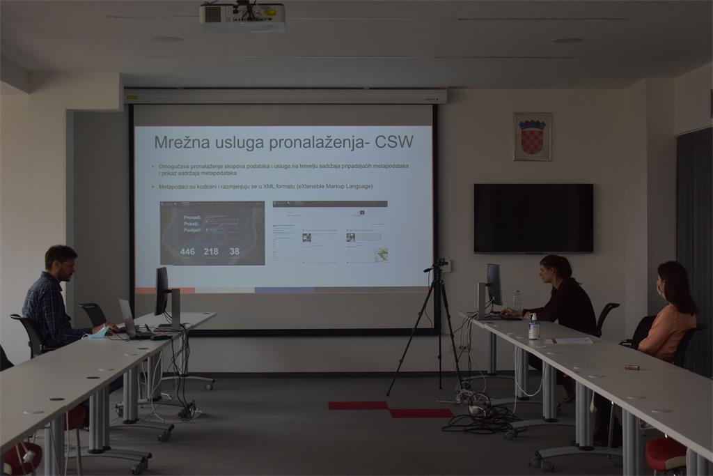
This was followed by a lecture "Network Services" by Tanja Rodin, MsC. The purpose of this lecture was to get acquainted with the basics of network services that represent an obligation for development by NSDI subjects, as defined by the NSDI Act, which transposed the INSPIRE Directive.
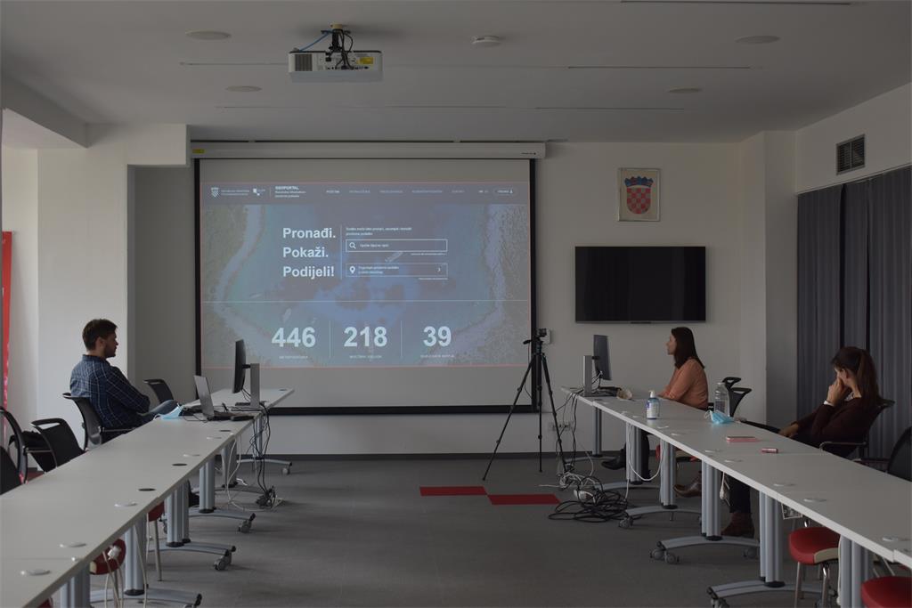
The last lecture "GeoHrvatska" was held by Iva Gašparović, PhD, who through this lecture presented the GeoHrvatska browser, which is established, developed and maintained by the State Geodetic Administration. GeoHrvatska is an example of a browser in which spatial data are displayed through interoperable network services served by the institutions responsible for their management.
| 24th NSDI WORKSHOP PROGRAM | ||
| TIME | AUTHORS AND PRESENTATION TITLES | FORMAT |
| 9:30-9:35 |
Workshop opening (Damir Šantek, PhD, SGA Director General) |
|
| 9:35-9:40 | Introduction to the workshop (Ljerka Marić, MSc, and Tomislav Ciceli, MSc) | |
| 9:40-10:20 | Introduction to the NSDI; Anyone can easily find, understand and use spatial data (Tomislav Ciceli, MSc) | |
| 10:20-10:30 | Interaction with participants | |
| 10:30-10:40 | NSDI Registers (Tanja Rodin, MSc) | |
| 10:40-10:55 | NSDI Metadata Catalog/NSDI Geoportal (Iva Gašparović, PhD) | |
| 10:55-11:05 | Network services (Tanja Rodin, MSc) | |
| 11:05-11:15 | GeoHrvatska (Iva Gašparović, PhD) | |
| 11:15-11:25 | Discussion | |
| 11:25-11:30 | Workshop closing | |
