

The State Geodetic Administration as the National Contact Point for NSDI and INSPIRE establishes, maintains and develops the NSDI Geoportal. In order to further improve the NSDI Geoportal, a new possibility was developed, the so-called swipe tool that enables visual overlapping of different layers.
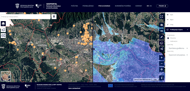
This feature is used to visualize the overlay of different data layers and thus helps in determining the suitability of a certain data layer for the required purpose. It enables visual analysis of selected layers and is useful in tracking changes in data.
The tool is easy to use in a few steps:
- Adding layers of interest to the viewer (by searching the Metadata Catalog, via a direct link to a network service, or by importing a spatial file)
- Starting the “Swipe tool” functionality
- Selection of orientation - possible vertical or horizontal overlapping of layers
- Determining how the layers overlap (which is the top layer and which is the bottom layer)
The State Geodetic Administration is continuously improving the NSDI Geoportal in accordance with the needs of users and has several new functionalities of the NSDI Geoportal in preparation, about which you will be soon informed.