

Magazine Geospatial World is made four month online research on more than 650 magazine readers. Research was conducted to get a broad understanding of geospatial technology usage;spatial data availability and usability; software and hardware dynamics and challenges of the users across the world.
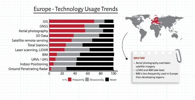
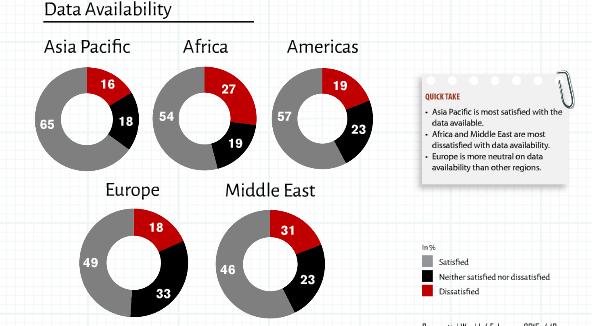
Not surprising results where GIS is the most used technology globally with GNSS and satellite remote sensing closely following in second and third positition. Availability of geospatial data, which has been a concern until recently, is no longer an issue world over thanks to the proliferations of sensors.
Data is at the core of geospatial technology.For several years, the lower awareness levels of geospatial technology and lover uptake have been attributed to the lack of data. Not any longer!
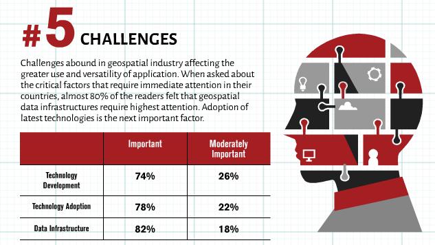
Challenges abound in geospatial industry affecting the greater use and versatiility of applications. Whwn asked about the critical factors that require immediate attention in their countries, almost 80% of the readers felt that geospatial data infrastructures require highest attention. Adoption of latest technologies is the next important factor.
Complete overview of the research is available on http://geospatialworld.net/uploads/magazine/February-2015-Geospatial-World-Magazine/files/9.html .