

The conference “SDI Day 2021” consisted of two parts: the first, which included a grand opening followed by an invited lecture, and ended with a round table, and the second, which included a series of lectures arranged in two sessions. This year’s conference presented through round table and lectures held, significant turning points in the development of NSDI and INSPIRE, as well as in their future applications for the purpose of building digital twins, using high-value spatial data and the European Union Green Plan. Great emphasis was placed on new technologies for collecting and processing of spatial data and their role in spatial data infrastructures, and also a special attention was paid to the topics of spatial data management in crisis situations.

12. NSDI and INSPIRE day began with the grand opening of the conference which was opened by Damir Šantek, PhD, Director General of the State Geodetic Administration and President of the NSDI Council, and the audience was addressed by Ljerka Marić, MsC, Head of the Spatial Data Infrastructure Sector of the State Geodetic Administration, Adrijan Jadro, President of the Croatian Chamber of Certified Geodetic Engineers and Željko Obradović, Director of the Federal Administration for Geodetic and Property Affairs of Bosnia and Herzegovina and President of the SDI Bosnia and Herzegovina Council.
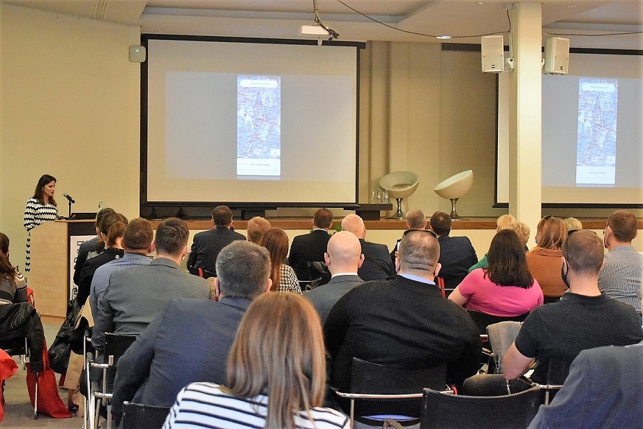
The „SDI Day 2021“ conference brought a handful of news from the field of spatial data infrastructures, and one of the most important was the announcement of the mobile application GeoCroatia announced by Iva Gašparović, PhD. On this occasion, she presented the application, which will contain numerous functionalities of practical importance for citizens, as well as the inclusion of interesting and new, additional spatial data from the competence of public authorities.
Invited lecture entitled "Geographical names in spatial data systems" was given by prof. Josip Faričić, PhD, from the Department of Geography, University of Zadar, who is also a member of the Commission for Standardization of Geographical Names. This lecture was particularly interesting and brought in an understandable and clear way the problem of geographical names closer through a series of real examples. The need for standardization of geographical names was especially emphasized, and bodies dealing with these issues were presented, such as the United Nations Group of Experts on Geographical Names (UNGEGN) at the global level, and the Commission for the Standardization of Geographical Names at the national level.

The invited lecture was followed by a round table entitled “NSDI; where are we today?”, moderated by Tomislav Ciceli, MsC, Head of the NSDI Division, participated Željko Obradović, Director of FGU B&H, prof. Vlado Cetl, PhD, full professor at the University of the North, Darko Šiško, PhD, Head of the City Office for Strategic Planning and City Development in the City of Zagreb, Dragan Divjak, MsC, director of List informatika d.o.o. and Damir Šantek, Phd, Director General of the State Geodetic Administration. The round table covered three topics: "Crisis Management", "NSDI Strategy 2020" and "NSDI / INSPIRE after INSPIRE". An impressive discussion was developed on these topics between leading experts from the country and the region on the need for timely and accurate spatial information in crisis situations such as the earthquakes in Petrinja and Zagreb in order to save lives and property. The need to make additional efforts to achieve the goals of NSDI and INSPIRE through the inclusion of spatial data and raising their quality was also pointed out. Finally, the direction of development of NSDI and INSPIRE was presented as a basis for building of the already mentioned digital twins, strengthening the application of high-value spatial data sets and the realization of the Green Plan of the European Union.
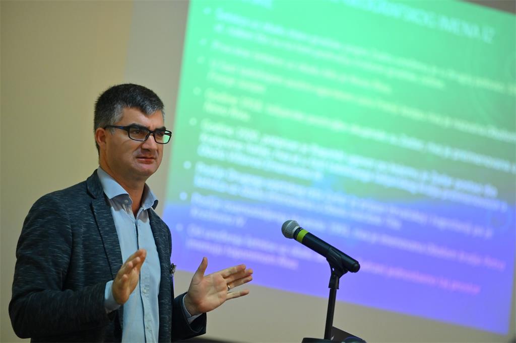
In the second part of the conference two sessions followed that contained interesting lectures from the field of NSDI and spatial data. Each session consisted of four lectures given by experts from the public, private and academic sector. Lectures covered topics such as the implementation of the INSPIRE directive, and the implementation and development of NSDI in the Republic of Croatia, but also in the immediate environment, and the application of new technologies for the purpose of their realization. Topics of practical application of NSDI and spatial data available through NSDI were also covered, and new possibilities for collecting and processing spatial data were presented.
After the conference, the participants expressed their satisfaction with the conference in terms of the importance of the received information, as well as with the dynamics of the activities on the 12th NSDI and INSPIRE day.
We thank all the lecturers and participants who made the SDI Day 2021 extremely educational, innovative, interesting and above all useful.
| PROGRAMME OF THE 12th NSDI AND INSPIRE DAY | ||
| TIME | AUTHORS AND LECTURE TITLES | FORMAT |
| 10:00–10:30 | Grand opening | |
| 10:30–11:15 | Prof. Josip Faričić, PhD: Geographical names in spatial data systems | |
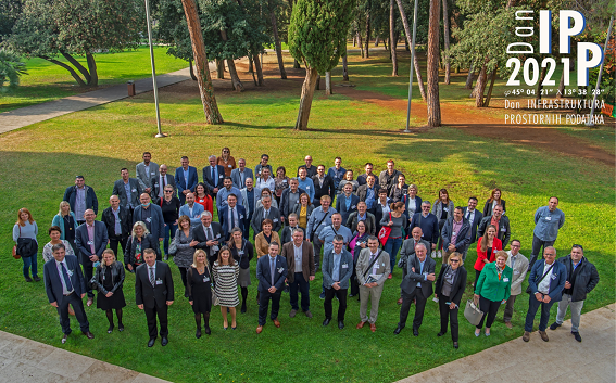
| 11:15–11:45 | Group photo Coffee break |
|
| 11:45–13:00 | ROUND TABLE: "NIPP; where are we today?" Moderator: Tomislav Ciceli, MsC, Head of the NSDI Division Participants: Željko Obradović, President of the BIH SDI Council, Director of FGU BIH
Prof. Vlado Cetl, PhD, full time professor, University of North
Darko Šiško, PhD, Assistant Head at City office for strategic planning and development, City of Zagreb
Dragan Divjak, MsC, Company Director at List informatika d.o.o.
Damir Šantek, PhD, President of the NSDI Council, Director General of the SGA
|
PDF |
| 13:00–14:00 | Lunch break | |
| I. session - Olive Hall | ||
| 14:00–15:00 |
Rodin T., Gašparović I.:
Overview of activities on the NSDI Geoportal and the GeoCroatia browser Matijević H., Pleić M, Škvorc M., Kardum D., Zadro Salameh P.:
Transition to the new NSDI metadata profile Turković M., Obad T.:
Spatial data life cycle and INSPRIE compliance in open source technologies Tabučić D., Obradović Ž.: Data integration & interoperability for public service provision in Federation of Bosnia and Herzegovina |
PDF |
| 15:00-15:15 | Coffee break | |
| II. session - Olive Hall | ||
| 15:15–16:15 | Kršulović D., Ciceli T.: Development of the Register of Geographical Names Šiško D., Škreblin N., Gavrilović V., Skender I.: Spatial data in emergency management and post-earthquake reconstruction in Zagreb and Petrinja Gašparović M., Klobučar D., Gašparović I., Molak-Župan Ž.: Monitoring of forest condition by remote sensing methods Rasol D., Ivatek Šahdan S., Kovačević D.: Croatian Meteorological and Hydrological Service Central Integration Platform - CIP |
PDF |
| 16:15–16:30 | Closing | |