

The workshop was intended for public authorities that are not NSDI subjects, but have spatial data under their jurisdiction in accordance with the NSDI Act.
The aim of the workshop was to encourage local self-government units to join the NSDI and to register spatial data sources from their jurisdictions in the NSDI Registers, as the first step towards inclusion in the NSDI. The ultimate goal is to increase the availability of spatial data from the local level and thereby encourage the sharing and reuse of data as well as the development of the spatial data infrastructure itself.
The workshop was opened by Ljerka Marić, MSc, Head of the Spatial Data Infrastructure Sector, who emphasized the importance of establishing the NSDI and the role of the SGA as the NSDI Contact Point.
The first presentation, titled “Everyone can understand and use spatial data“, was held by Tomislav Ciceli, MSc, Head of the National Spatial Data Infrastructure Division. The presentation explained the fundamental concepts of the NSDI and the legal frameworks at both the National and European levels. Participants were informed about the legal obligations of NSDI subjects and the duties of the SGA as the Contact Point, as well as the basics of the NSDI Registers, the NSDI Geoportal, and the GeoHrvatska browser.
The second presentation, “NSDI Geoportal and GeoHrvatska,” was given by Iva Gašparović, PhD. The lecture presented the legal basis of the Geoportal, its components and functionalities available to users, as well as the GeoHrvatska browser and its accompanying mobile application.
The next presentation, titled “The basics of Metadata,” was delivered by Tanja Rodin, MSc. The presentation explained the key features of metadata, tools for their creation and validation, and the importance of producing high-quality and relevant metadata in the process of establishing and maintaining the NSDI.
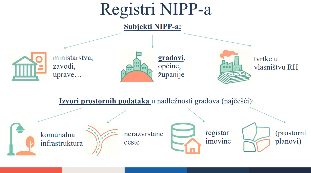
The final presentation, “NSDI Registers,” was given by Ana Geceg, Head of the Department for NSDI Coordination and Interoperability. The presentation included a theoretical and a practical part. The theoretical section explained the fundamental concepts and legal basis for including subjects in the NSDI Registers, while the practical part demonstrated an example of data entry into the Registers through the editor user interface, including detailed instructions for entering data for generating a new subject and spatial data source.
The State Geodetic Administration, as the National Contact Point for the NSDI, continues to make efforts to ensure support to NSDI subjects at all stages of inclusion and to enable further establishment and development of the NSDI in the Republic of Croatia.
| 43rd NSDI WORKSHOP PROGRAM | |||
|---|---|---|---|
| SCHEDULE | LECTURE TITLE | SPEAKER | FORMAT |
| 10:00 - 10:10 | Introduction | ||
| 10:10 - 10:30 | Everyone can understand and use spatial data | Tomislav Ciceli, MSc | PDF (in Croatian) |
| 10:30 - 10:45 | NSDI Geoportal and GeoHrvatska | Iva Gašparović, PhD | PDF (in Croatian) |
| 10:45 - 11:00 | The basics of Metadata | Tanja Rodin, MSc | PDF (in Croatian) |
| 11:00 - 11:45 | NSDI Registers - practical part of the workshop | Ana Geceg | PDF (in Croatian) |
| 11:45 - 12:00 | Discussion | ||
| 12:00 | Workshop ending | ||