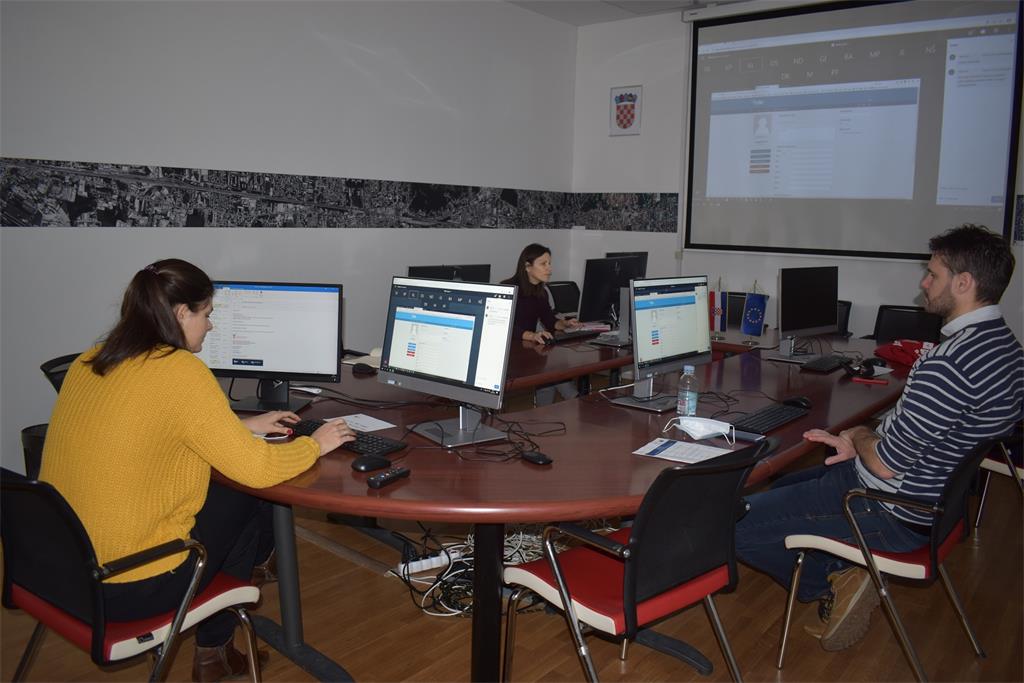
The twenty-fifth NSDI workshop entitled "Data harmonization and development of network services" was organized by the State Geodetic Administration as the National Contact Point of the National Spatial Data Infrastructure (NSDI) within the project "Increasing the availability of NSDI spatial data through e-services" which is co-financed by the European Regional Development Fund. The workshop was held in the form of six virtual sessions in the period 1.-8. March 2021 through the GoToMeeting platform, and was intended for selected NSDI subjects and employees of the State Geodetic Administration.

Through 6 days of training, participants had the opportunity to learn more about the INSPIRE conceptual model, XML and INSPIRE GML application schemas, INSPIRE data specifications, and also to practically work in hale>>studio and hale>>connect software solutions. Also, practical work was organized on the harmonization of data with the INSPIRE Implementing Rules and the development of network services using the software solutions hale>>studio and hale>>connect, whereby as a final product of training view and download services and their metadata were developed. After the training, participants can continue to use these solutions and create network services for data under the jurisdiction of NSDI subjects.

The workshop was opened by Tanja Rodin, MsC, Head of the NSDI Interoperability Department, who greeted all present, followed by an individual presentation of representatives of selected NSDI subjects and SGA employees. Through all sessions participants were guided by Kate Lyndegaard, a representative of the German company wetransform, which develops the specified software solution.
The first session held on March 1, 2021, was aimed at getting acquainted with the theoretical foundations, and thus an introduction to UML, INSPIRE conceptual models, as well as XML and INSPIRE GML application schemas were presented.
During the next session, held on March 2, 2021, the INSPIRE data specifications were presented, which contain and describe in detail spatial data according to a specific theme, as well as the prescribed rules and recommendations for their implementation. After the introductory part, the practical work in the hale>>studio application began, so that the workshop participants could get acquainted with the basic processes and transformations in the said application.
The third session, held on March 3, 2021, was entirely focused on a closer acquaintance with the hale>>studio and practical work in it. A detailed description of types and grouped functions were presented, so in this application there are general, geometric, groovy and numerical functions for data manipulation. Participants were also able to explore the user interface and application capabilities, one of which basic capability is data visualization.
The next day, 4.3.2021., a session entitled "Introduction to hale >>connect" followed. The workshop participants were thus introduced to the next step in the process of developing and publishing network services and their metadata in accordance with the INSPIRE Implementing Rules through the hale>>connect software solution.
Through the session held on March 5, 2021, workshop participants continued to work in the hale>>connect, and in the meantime the possibilities of validation of created network services and metadata through the mostly well-known and publicly available validation tools - INSPIRE Validator and Linkage checker tool were explained.
The last session was held on March 8, 2021, and through it the possibilities and obligations of changing metadata were explained in detail, so that they could be applied to one or more spatial data sources. All participants showed great interest in working with the software solutions hale>>studio and hale>>connect for the purpose of creating INSPIRE compliant network view and download services, as well as related metadata, so that after the training they can independently implement these procedures.
The workshop was co-financed by the European Regional Development Fund (ERDF), in accordance with the Operational Program "Competitiveness and Cohesion 2014-2020", and within the Grant Agreement KK.02.2.1.01.0016 "Increasing the availability of NSDI spatial data through e-services”.
| 25th NSDI WORKSHOP PROGRAM | ||
| TIME | AUTHORS AND PRESENTATION TITLES | |
| 1.3.2021. (9:00-11:30) | Introduction to UML, INSPIRE conceptual model, XML and INSPIRE GML application schemas | |
| 2.3.2021. (9:00-11:30) | Introduction to INSPIRE data specifications and to basic processes and transformations with hale>>studio | |
| 3.3.2021. (13:00-15:30) | Transformation of data into INSPIRE (Part I) | |
| 4.3.2021. (9:00-11:30) | Introduction to hale>>connect | |
| 5.3.2021. (9:00-11:30) | Publication of metadata and services | |
| 8.3.2021. (9:00-11:30) | Transformation of data into INSPIRE (Part II) | |