

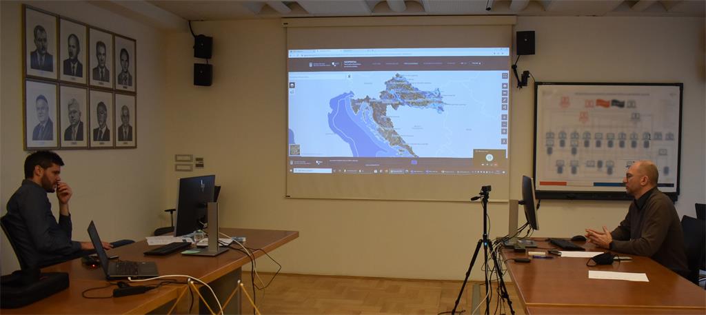
23rd NSDI workshop, as the last from the first cycle of workshops under the common title "Inclusion of local and regional self-government units in the National Spatial Data Infrastructure" was held on 11 February 2021. The workshop was organized by the State Geodetic Administration through the virtual platform Microsoft Teams within the implementation of the project "Capacity Building for the establishment of the NSDI", which is co-financed by the European Social Fund. The participants of the workshop were representatives of local and regional self-government units from the area of Split-Dalmatia, Dubrovnik-Neretva, Zadar, Šibenik-Knin and Sisak-Moslavina counties. A total of 54 participants attended the workshop, including SGA employees.

23rd NSDI workshop was opened by dr. Sc. Damir Šantek, Director General of the State Geodetic Administration, who commented on recent events, especially in the Sisak-Moslavina County, which showed the need for timely, urgent and accurate spatial data. He also emphasized the importance of the widespread use of spatial data, for a large number of which the SGA is responsible.

Those present were greeted by Ljerka Marić, MSc, Head of the Spatial Data Infrastructure Sector, who briefly presented the SDI Sector and its internal organizational unit responsible for the implementation of the NSDI Act - NSDI Service. The participants were also greeted by Tomislav Ciceli, MSc, Head of the NSDI Service, who presented the project and the program of the workshop.

The opening of the workshop was followed by the first lecture entitled “Introduction to NSDI; Anyone can easily find, understand and use spatial data” held by Tomislav Ciceli, MSc. This lecture gave an overview of the establishment, maintenance and development of the NSDI through an overview of the legal, technical, strategic and time frame of the NSDI. In addition, the activities of raising awareness and supporting NSDI stakeholders through 11 thematic conferences and 18 workshops held so far were highlighted.
This was followed by a short questionnaire, in which the workshop participants answered questions about the basics and understanding of the purpose of the NSDI, and also about the sources of spatial data from their jurisdiction. In this area, after the introductory lecture, the participants showed a good understanding of the purpose and benefits that NSDI brings.
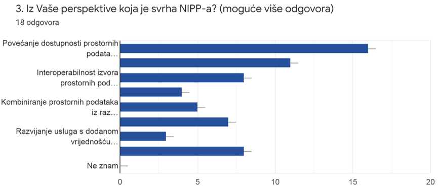
The picture shows the answers to the 3rd question from the questionnaire that show a good understanding of the purpose of NSDI after the lecture. |
 |
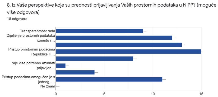
The picture shows the answers to question 8 from the questionnaire that show a good understanding of the benefits of reporting spatial data within the jurisdiction of NSDI subjects in NSDI. |
 |
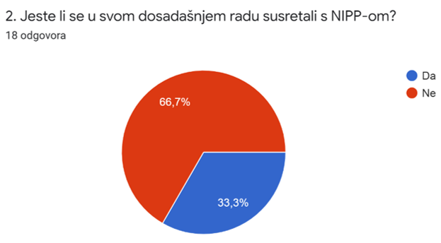
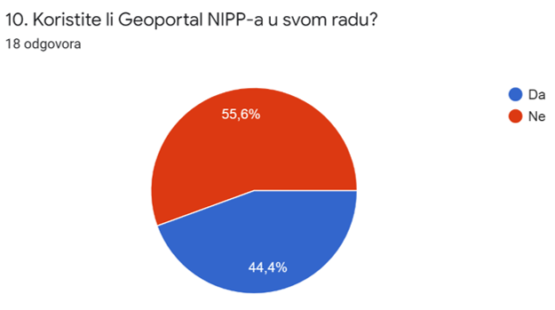
Significant answers were obtained to questions 2 and 10 of the questionnaire, which showed a poor encountering with NSDI and its main product - NSDI Geoportal, which confirms the need for implementing this project and hold workshops.
The picture shows the answers to the 2nd question from the questionnaire which show a weak encounter of the workshop participants with the NSDI. |
 |
 |
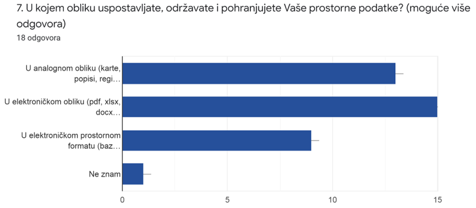
The questionnaire also provided feedback on the form of establishment, maintenance and storage of the spatial data under the jurisdiction of local and regional self-government units, which showed that a large number of them still maintains spatial data in analog form.
The picture shows the answers to question 7 from the questionnaire which show that a large number of local and regional self-government units continue to establish, maintain and store spatial data from their jurisdiction in an analogue form. |
 |
The next lecture "NSDI Registers" was given by Tanja Rodin, MSc. This lecture described the first step in the inclusion of the subjects in the NSDI, ie the registration of subjects in the Register of NSDI subjects, as well as spatial data sources from their jurisdiction in the Register of NSDI spatial data sources. The legal basis for becoming the NSDI subject and the jurisdiction over spatial data sources were also given.
The final step in the inclusion of local and regional self-government units in the NSDI was presented through a lecture by Iva Gašparović, PhD, entitled "NSDI Metadata Catalog/NSDI Geoportal". In her lecture, she presented the NSDI Geoportal which is established, maintained and developed by the State Geodetic Administration as the National Contact Point for the NSDI. Its possibilities and components were presented, and especially as one of them, the NSDI Metadata Catalog and its elements that NSDI subjects are obliged to fill in for spatial data sources within their jurisdiction.
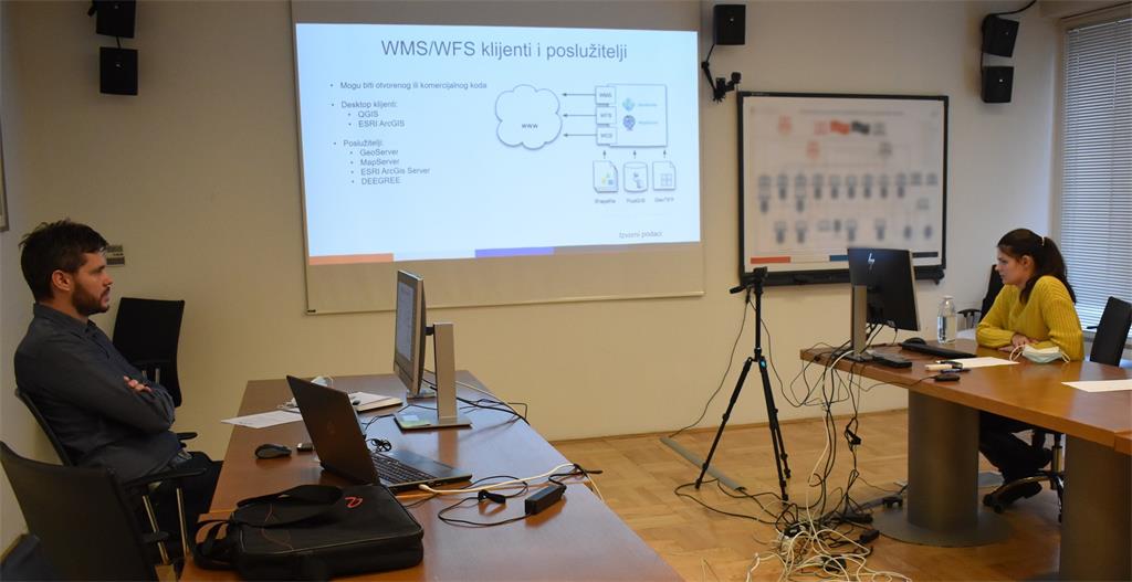
Lecture "Network Services" by Tanja Rodin, MSc, included an overview and development of INSPIRE network services that NSDI subjects are obliged to develop for sets and series of spatial data sets within their jurisdiction. Definitions of network services were given and their way of functioning is explained.
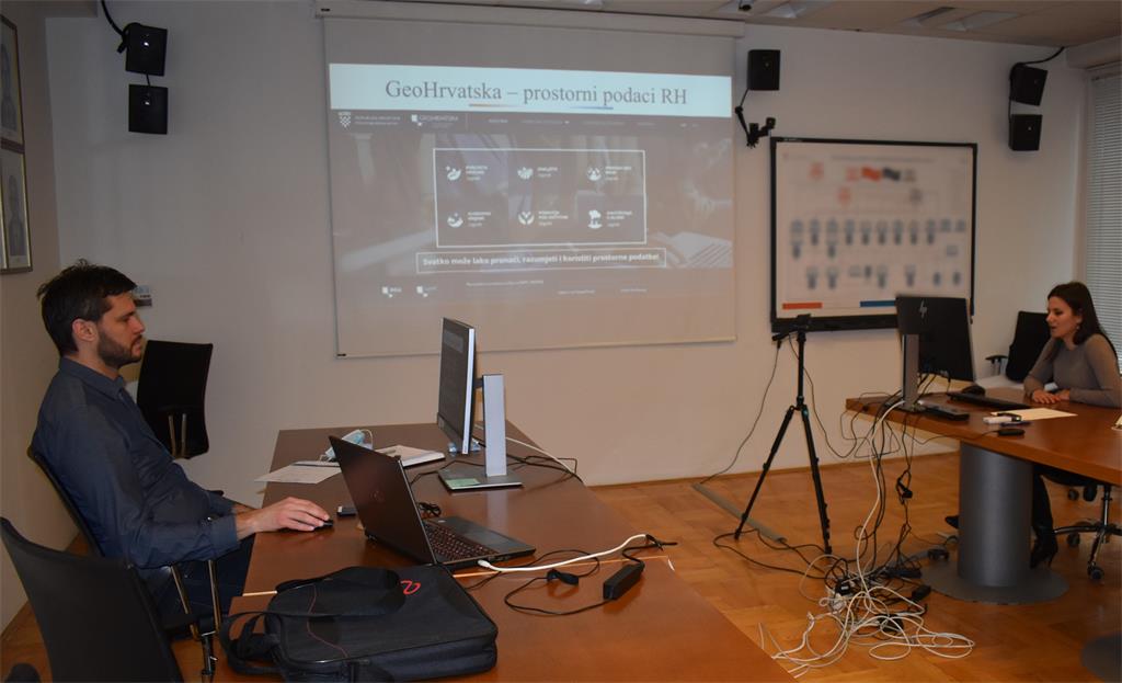
Iva Gašparović, PhD, gave the last lecture entitled "GeoHrvatska". This lecture presented the basic goal of the NSDI: to make spatial data of public authorities of the Republic of Croatia available to citizens, which the SGA achieves by establishing the GeoHrvatska browser, intended for the general population.
| 23rd NSDI WORKSHOP PROGRAM | ||
| TIME | AUTHORS AND PRESENTATION TITLES | FORMAT |
| 10:00–10:05 |
Workshop opening (Damir Šantek, PhD, SGA Director General) |
|
| 10:05–10:15 | Introduction to the workshop (Ljerka Marić, MSc, and Tomislav Ciceli, MSc) | |
| 10:15–10:55 | Introduction to the NSDI; Anyone can easily find, understand and use spatial data (Tomislav Ciceli, MSc) | |
| 10:55–11:10 | Interaction with participants | |
| 11:10–11:30 | NSDI Registers (Tanja Rodin, MSc) | |
| 11:30–11:40 | Pause | |
| 11:40–12:05 | NSDI Metadata Catalog/NSDI Geoportal (Iva Gašparović, PhD) | |
| 12:05–12:30 | Network services (Tanja Rodin, MSc) | |
| 12:30–12:40 | GeoHrvatska (Iva Gašparović, PhD) | |
| 12:40–13:00 | Discussion | |
| 13:00 | Workshop closing | |
