The third cycle of NSDI workshops under the common title "Inclusion of local and regional self-government units in the National Spatial Data Infrastructure (NSDI)" was opened by the 29th NSDI workshop, which was held on April 14, 2021 in the form of a virtual workshop through the Microsoft Teams network platform. The workshop was organized by the State Geodetic Administration within the implementation of the project "Capacity building for the establishment of the NSDI", which is co-financed by the European Social Fund, and was attended by a total of 54 participants.
The workshop was opened by Damir Šantek, PhD, director general of the State Geodetic Administration, who is also the President of the NSDI Council, a body that establishes the NSDI in the Republic of Croatia and coordinates the activities of NSDI subjects.
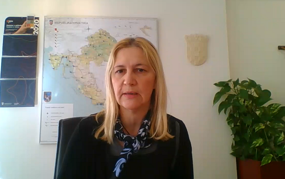
Those present were then addressed by Ljerka Marić, MsC, Head of the Spatial Data Infrastructure Sector, who on this occasion emphasized the obligation to implement the INSPIRE Directive on the European Union level. The participants were also addressed by Tomislav Ciceli, MsC, who presented the specified project and the program of the 29th NSDI workshop.
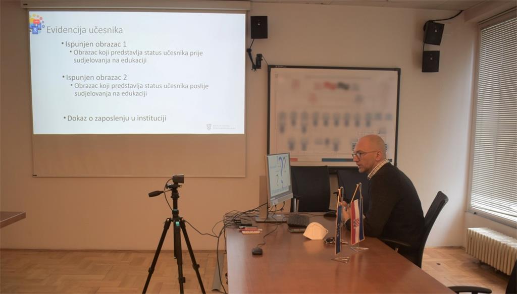
This was followed by an introductory lecture by Tomislav Ciceli, MsC, “Introduction to the NSDI; Anyone can easily find, understand and use spatial data." This lecture presented the theoretical foundations of the NSDI, its establishment and development, as well as the obligations arising from it. Among other things, the NSDI goals for the period 2016-2020 were presented in detail in order to bring the NSDI activities closer to the participants and create a broad basis that will simplify the inclusion in the NSDI of the workshop participants, ie representatives of local and regional self-government units.
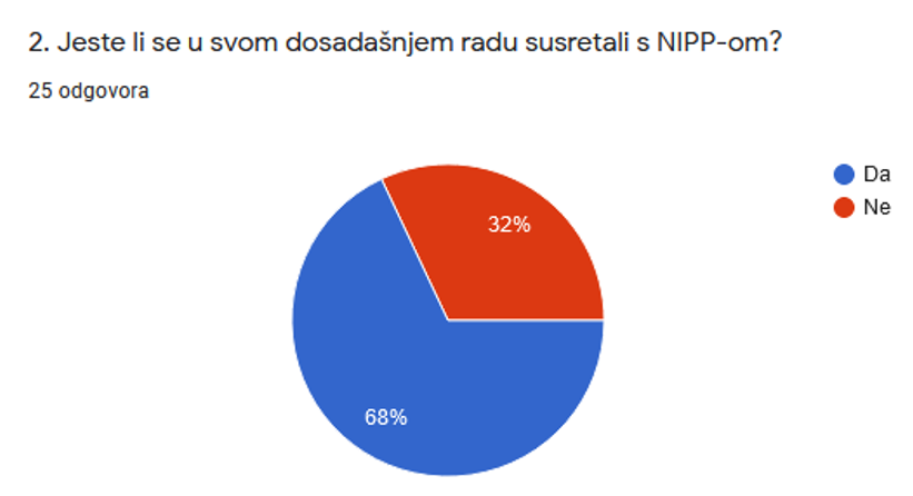
In order to obtain feedback from participants on their knowledge and understanding of the NSDI, a short anonymous questionnaire was conducted. The obtained results showed that further investment is needed in order for the NSDI to be used to its maximum, and for the benefits it brings to be complete. The picture below shows that 32% of the present representatives of local and regional self-government units have not met in their work with the NSDI so far.
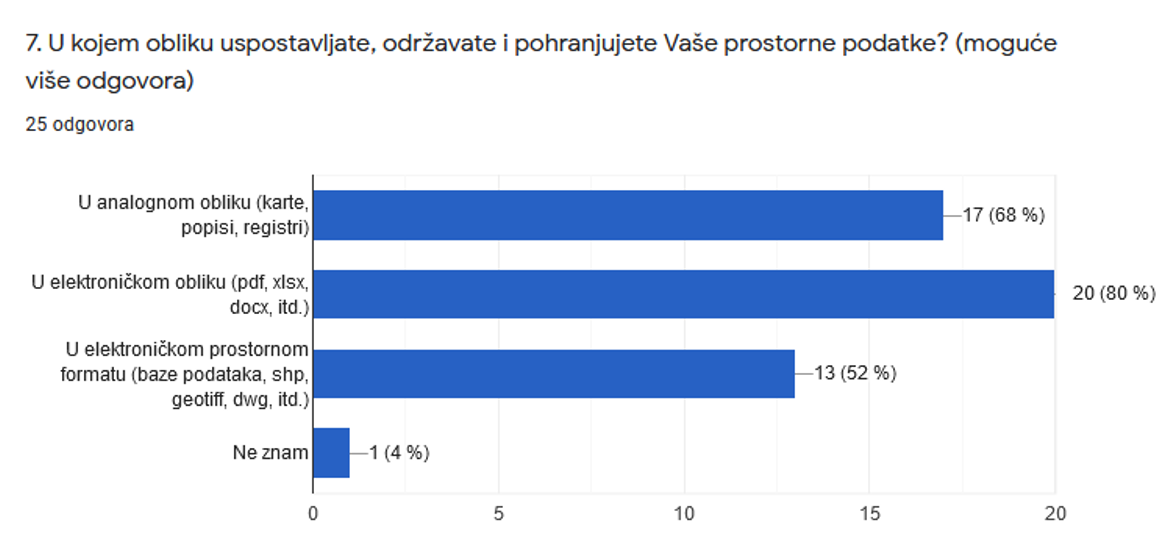
The answers to question 7 are also significant, showing that a large number of local and regional self-government units continue to establish, maintain and store spatial data from their jurisdiction in an analog form, as many as 68% of them, which represents an obstacle in the future use of such spatial data.
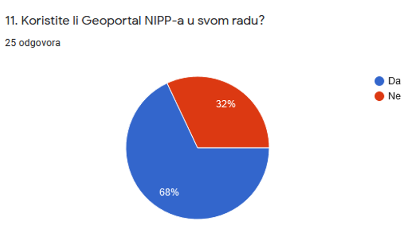
One of the main purposes of the NSDI Geoportal is to make spatial data of public authorities available. The answers received to the 11th question show that a large share of attendees (32%) do not use the NSDI Geoportal in their work, which confirms the need to implement the project "
Capacity building for the establishment of the NSDI" and for additional investments, in order to increase the use of the Geoportal NSDI.
After this short interaction with the participants, a lecture by Tanja Rodin, MsC, entitled "NSDI Registers" followed. This lecture presented the first step in inclusion in the NSDI through the registration of subjects in the Register of NSDI subjects, and then the sources of spatial data from their jurisdiction in the Register of spatial data sources of the NSDI. Special attention was paid to the overview of types of spatial data within the jurisdiction of local and regional self-government units according to the Local and Regional Self-Government Act and their connection to spatial data themes as defined by the NSDI Act (OG
56/13,
52/18,
50/20).
The next lecture by Iva Gašparović, PhD, "NSDI Metadata Catalog/NSDI Geoportal" presented to the workshop participants the second step in inclusion in the NSDI - entry of metadata for spatial data sources under the jurisdiction of NSDI subjects in the Metadata Catalog. The main components of the NSDI Geoportal and its functionality were presented, and a brief overview of the basic elements of metadata was given.
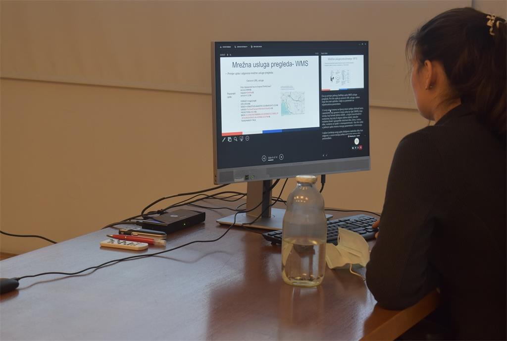
Lecture by Tanja Rodin, MsC, "Network Services" was focused on the theoretical foundations and overview of network services, the development of which for the reported spatial data sources is an obligation for NSDI subjects. In addition, the basic purposes of their development were highlighted, such as interoperability between different software applications, availability and up-to-date spatial data, ease of use and the possibility of combining data from different institutions and locations.
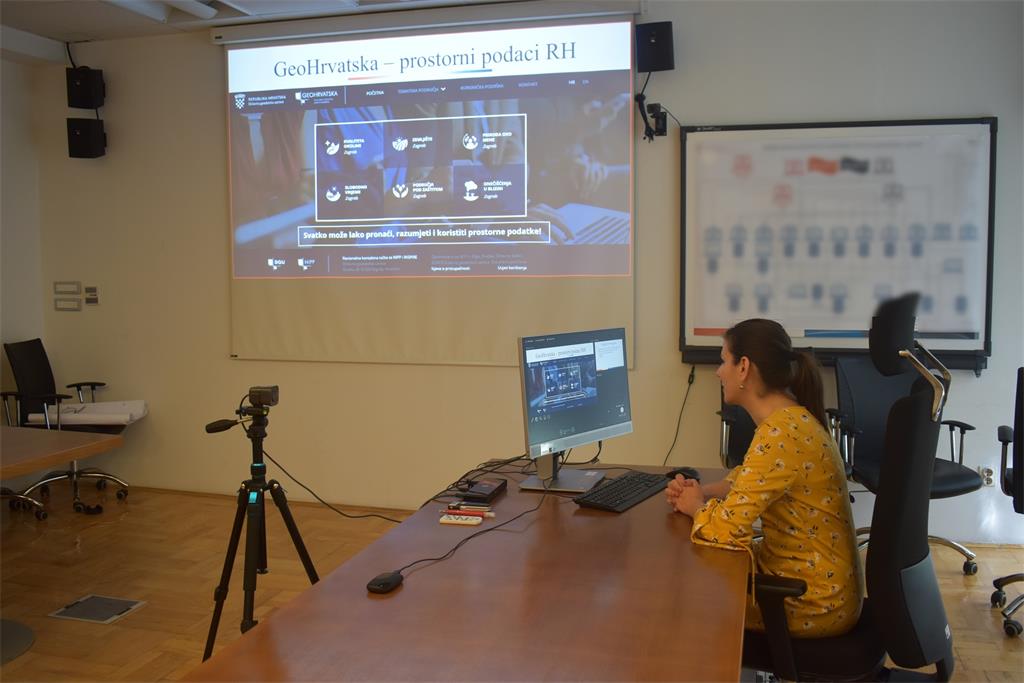
The final lecture entitled "GeoHrvatska" was given by Iva Gašparović, PhD. This lecture presented the GeoHrvatska browser, which is established, maintained and developed by the State Geodetic Administration, and is currently in the test phase. This browser is one of the basic products of the NSDI, which is intended for citizens, and contains the spatial data of public authorities of the Republic of Croatia (NSDI subjects).
The State Geodetic Administration is preparing additional thematic workshops, which will be focused on practical work on entering metadata in the Metadata Catalog on the NSDI Geoportal.
| 29th NSDI WORKSHOP PROGRAM |
| TIME |
AUTHORS AND PRESENTATION TITLES |
FORMAT |
| 9:30-9:35 |
Workshop opening (Damir Šantek, PhD, SGA director general)
|
|
| 9:35-9:40 |
Introduction to the workshop (Ljerka Marić, MSc, and Tomislav Ciceli, MSc) |
PDF |
| 9:40-10:20 |
Introduction to the NSDI; Anyone can easily find, understand and use spatial data (Tomislav Ciceli, MSc) |
PDF |
| 10:20-10:30 |
Interaction with participants |
|
| 10:30-10:40 |
NSDI Registers (Tanja Rodin, MSc) |
PDF |
| 10:40-10:55 |
NSDI Metadata Catalog/NSDI Geoportal (Iva Gašparović, PhD) |
PDF |
| 10:55-11:05 |
Network services (Tanja Rodin, MSc) |
PDF |
| 11:05-11:15 |
GeoHrvatska (Iva Gašparović, PhD) |
PDF |
| 11:15-11:25 |
Discussion |
|
| 11:25-11:30 |
Workshop closing |
|
Access to the NSDI website from which it is possible to download
forms for the purposes of project implementation (all forms are in Croatian language).