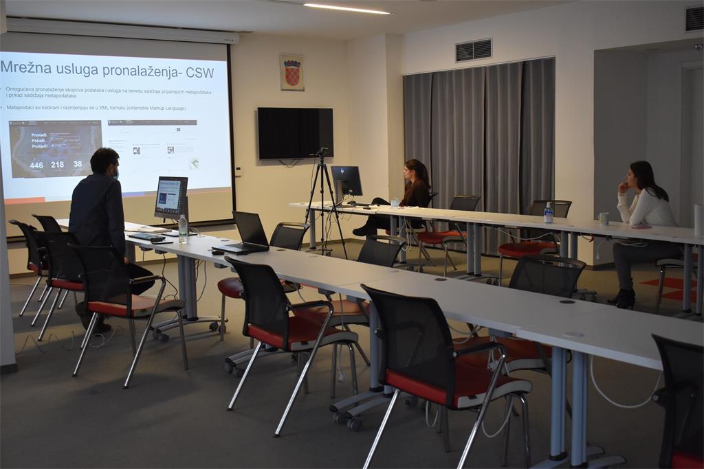

Those present were greeted by Ljerka Marić, MSc, Head of the Spatial Data Infrastructure Sector, who emphasized the dual role of the SGA, as a data provider (Digital cadastral plan, Register of Spatial Units…) and coordination of the establishment and development of the NSDI. She briefly introduced the Spatial Data Infrastructure Service, whose internal organizational unit is the NSDI Service, responsible for the implementation of the NSDI Act. The participants were also greeted by Tomislav Ciceli, MSc, Head of the NSDI Service, who presented the ESF project "Capacity Building for the establishment of the NSDI", within which a new cycle of NSDI workshops is held.
The first, introductory lecture entitled “Introduction to NSDI; Anyone can easily find, understand and use spatial data" was held by Tomislav Ciceli, MSc. The lecture presented the legal, strategic, technical and time framework for the establishment, maintenance and development of the NSDI, in order to acquaint the representatives of local and regional self-government units with the same, but also with the obligations arising from them.
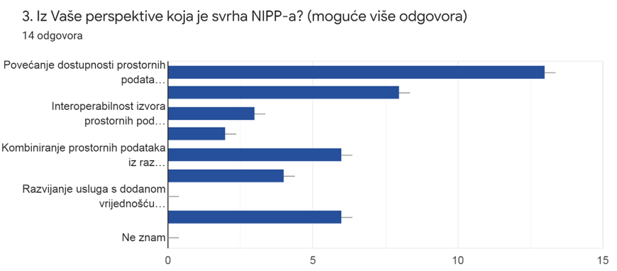
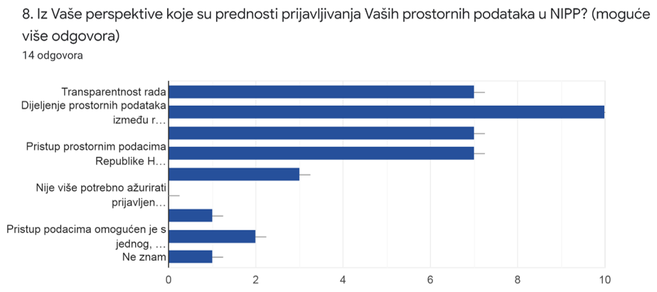
This was followed by a short questionnaire, in order to obtain feedback from an interaction with the participants on the knowledge of the NSDI, its purposes and the obligations of the participants as representatives of the NSDI subjects. The results showed that most participants understand well the goals and benefits of NSDI, but active involvement is needed to achieve them.
The picture shows the answers obtained to the 3rd question from the questionnaire. The answers obtained indicate a good understanding of the purpose of NSDI by the workshop participants. |
 |
The picture shows the answers obtained to the 8th question from the questionnaire. The obtained answers indicate a good understanding of the advantages of including spatial data to the NSDI by the workshop participants. |
 |
After the questionnaire Tanja Rodin, MSc, presented the NSDI Registers, which represent the first step in involving subjects in the NSDI. Thereby she interpreted the provisions of the NSDI Act relating to issues such as: who is the subject of the NSDI, what are the spatial data and which spatial data are part of the NSDI, as well as the procedure for registering subjects and sources of spatial data in the NSDI Registers.

The next lecture "NSDI Metadata Catalog / NSDI Geoportal" was given by Iva Gašparović, PhD. This lecture was dedicated to the final step of including subjects in NSDI, accompanied by detailed explanations of metadata input in order to facilitate the inclusion process to NSDI subjects, and to ensure further maintenance and development of spatial data sources and related metadata under the jurisdiction of the NSDI subjects.
Through the lecture "Network Services" Tanja Rodin, MSc, explained the development and types of network services, in accordance with the INSPIRE Directive, which was transposed into Croatian legislation through the NSDI Act.
The last lecture "GeoHrvatska" was given by Iva Gašparović, PhD, who briefly presented the GeoHrvatska browser, as one of the basic products of the NSDI intended for citizens.
| 19th NSDI WORKSHOP PROGRAM | ||
| TIME | AUTHORS AND PRESENTATION TITLES | FORMAT |
| 10:00–10:05 | Workshop opening (Antonio Šustić, deputy director general) | |
| 10:05–10:15 | Introduction to the workshop (Ljerka Marić, MSc, and Tomislav Ciceli, MSc) | |
| 10:15–10:55 | Introduction to the NSDI; Anyone can easily find, understand and use spatial data (Tomislav Ciceli, MSc) | |
| 10:55–11:10 | Interaction with participants | |
| 11:10–11:30 | NSDI Registers (Tanja Rodin, MSc) | |
| 11:30–11:40 | Pause | |
| 11:40–12:05 | NSDI Metadata Catalog/NSDI Geoportal (Iva Gašparović, PhD) | |
| 12:05–12:30 | Network services (Tanja Rodin, MSc) | |
| 12:30–12:40 | GeoHrvatska (Iva Gašparović, PhD) | |
| 12:40–13:00 | Discussion | |
| 13:00 | Workshop closing | |
Access to the NSDI website from which it is possible to download forms for the purposes of project implementation (all forms are in Croatian language).