

The purpose of the 36th NIPP workshop was to encourage work on the harmonization of data under the jurisdiction of public authorities in order to fulfill the obligations set by the INSPIRE Directive and the NSDI Act.
For this workshop, the Croatian Geological Institute and the data topic Geology were selected as the subject of NSDI. Geological data, primarily in the form of geological maps of various scales, constitute high-value data that have applications in many scientific fields and as such must be harmonized at the European level and available for view and download.
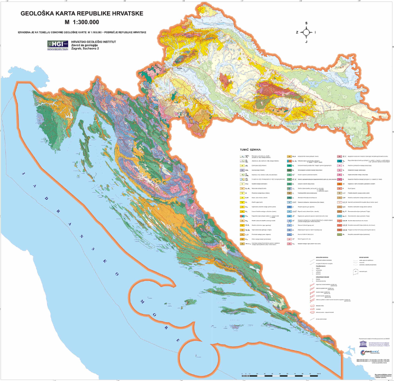
With this aim in mind, the workshop was held where geological map data from existing models were translated into the INSPIRE data model in the most precise way so that essential information from the original data would not be lost.
Harmonization of data represents one of the basic steps in the establishment, maintenance and development of NSDI, and can be performed using software packages for the transformation of spatial data.
For the purposes of the workshop, the FME (Feature Manipulation Engine) program package was used with the addition for INSPIRE data transformation, which performed mapping from one model to another and obtained the final data set in gml format. After the completed transformation, the data will be publicly published on one of the spatial data servers in the form of network view and download services.
The final goal is to have data from the topic of geology at the national level available on the INSPIRE Geoportal so that it can be visible to the entire European community.
The FME software solution was acquired within the framework of the ERDF project "Increasing the availability of spatial data of NSDI through e-services", the goal of which was to increase the availability of spatial data of public authorities, i.e. entities of NSDI, through the development of INSPIRE-compliant network services, and was implemented by State Geodetic Administration during 2021.