

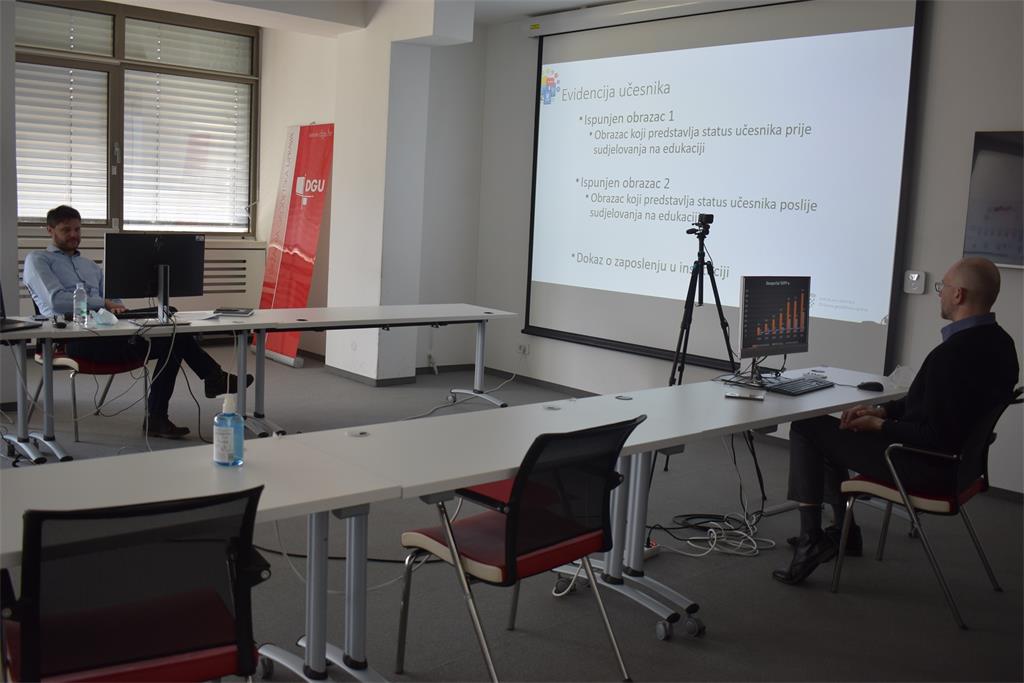
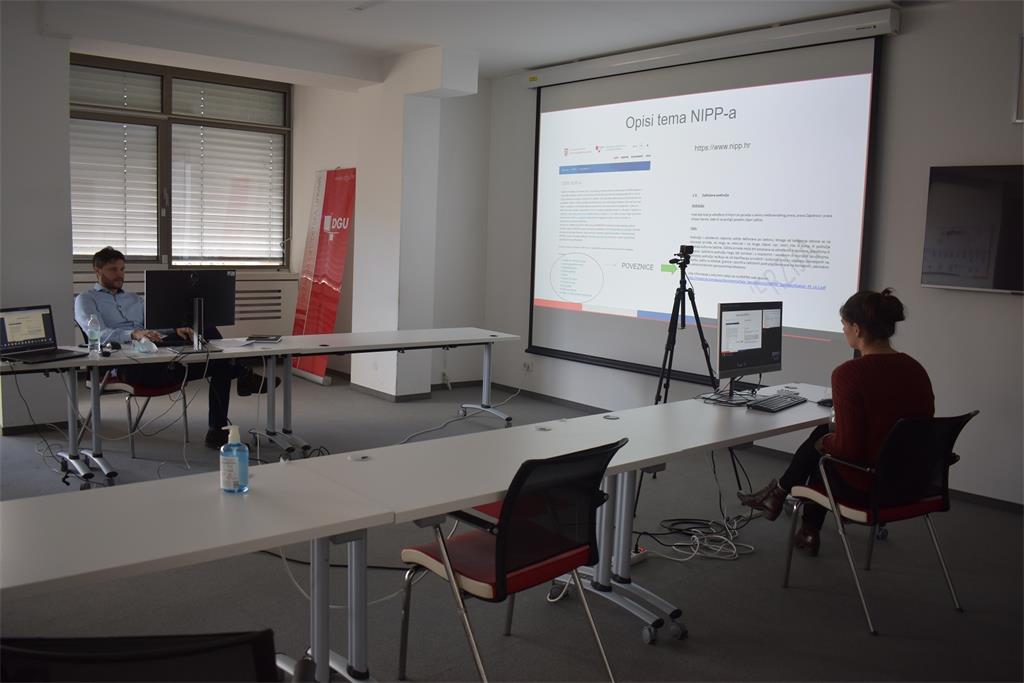
27th NSDI workshop from the new cycle of workshops under the common title "Inclusion of local and regional self-government units in the National Spatial Data Infrastructure (NSDI)" was held on March 16, 2021. The workshop was organized by the State Geodetic Administration within the implementation of the project "Capacity building for the establishment of the NSDI", which is co-financed by the European Social Fund, through the virtual platform Microsoft Teams. A total of 47 participants from Bjelovar-Bilogora, Varaždin, Split-Dalmatia, Požega-Slavonia, Vukovar-Srijem, Virovitica-Podravina and Karlovac counties attended, together with SGA employees.


The participants of the 27th NSDI workshop were then addressed by Ljerka Marić, MsC, Head of the Spatial Data Infrastructure Sector, who greeted all present and stressed the importance of the availability of spatial data of public authorities of the Republic of Croatia, as defined by the NSDI Act (OG 56/13, 52/18, 50/20) in which INSPIRE Directive is transposed, in order to meet obligations defined by the European Commission. Those present were then greeted by Tomislav Ciceli, MsC, Head of the NSDI Service, who briefly presented the project and program of the 27th NSDI workshop.

The purpose of this workshop was to get acquainted with the basics of the NSDI and the process of inclusion in the NSDI, to facilitate this process for new subjects, and to ensure their further independent work with spatial data sources and related metadata from their jurisdiction.
27th NSDI workshop started with the lecture “Introduction to NSDI; Anyone can easily find, understand and use spatial data” held by Tomislav Ciceli, MsC. This lecture presented the development and establishment of the NSDI, and the obligations arising from it, and special emphasis was placed on the benefits that the NSDI brings. The life cycle of spatial data was also explained, in order to bring this cycle closer to the participants, and to emphasize the last phase as the most important phase of this cycle - the sharing of spatial information.
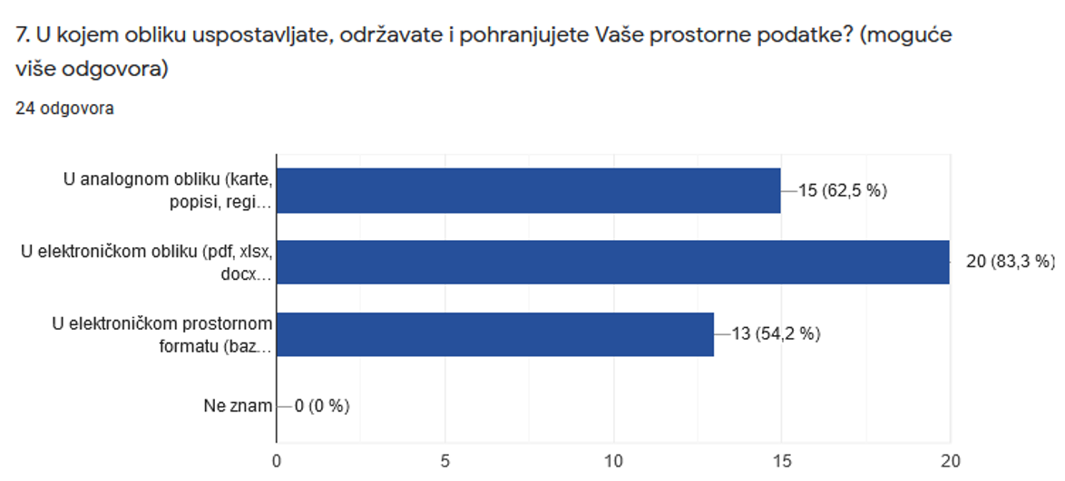
Also important are the answers to the seventh question from the questionnaire, which show that a large number of participants continue to establish, maintain and store spatial data from their jurisdiction in an analog form, which is represents an obstacle to their further use.
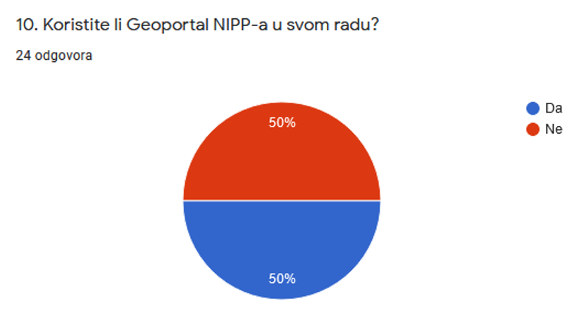
The answers obtained to the 10th question from the questionnaire show that half of the participants do not use the NSDI Geoportal in their work, which indicates the need to raise awareness about NSDI and use of its products.
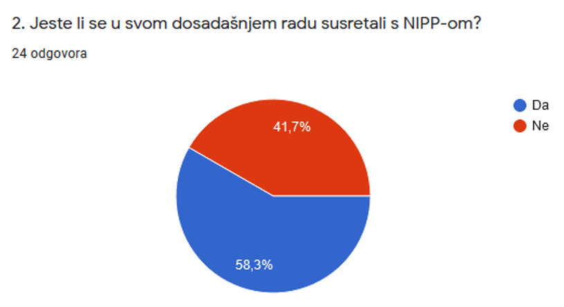
Lecture "NSDI Registers" by Tanja Rodin, MsC, which followed the questionnaire, presented the first step in inclusion in the NSDI through the registration of subjects in the Register of NSDI subjects, and then through the registration of spatial data sources under the jurisdiction of NSDI subjects in the Register of NSDI spatial data sources. The legal bases of becoming the NSDI subject are given, as well as the legal definition of the NSDI spatial data sources.
The next lecture, NSDI Metadata Catalog/NSDI Geoportal, was given by Iva Gašparović, PhD. This lecture presented one of the basic products of NSDI, which the State Geodetic Administration is obliged to establish, develop and maintain. An integral part of the NSDI Geoportal is the NSDI Metadata Catalog, in which spatial data sources (previously registered in the Register of Spatial Data Sources) describe metadata, which is an obligation for NSDI subjects. An integral part of the NSDI Geoportal is the NSDI Metadata Catalog, in which spatial data sources (previously registered in the Spatial Data Sources Register) are described by metadata, which represents an obligation for NSDI subjects.
The development of network services for existing sets or series of spatial data sets under the jurisdiction of local and regional self-government units also represents a legal obligation for NSDI subjects, and was presented by the lecture "Network Services" by Tanja Rodin, MsC. Through this lecture, participants were able to get acquainted with the basics of network services, and the network view and download services and their OGC standards - WMS and WFS - were presented in more detail.
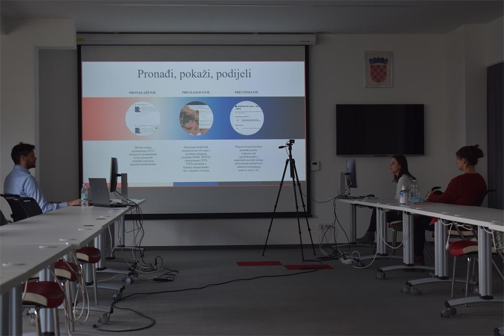
The last lecture entitled "GeoHrvatska" by Iva Gašparović, PhD, the participants had the opportunity to get acquainted with the GeoHrvatska browser, which is established, developed and maintained by the State Geodetic Administration. The GeoHrvatska browser is intended for citizens, and it serves the official spatial data of public authorities of the Republic of Croatia in an interoperable manner through online view and download services.
| 27th NSDI WORKSHOP PROGRAM | ||
| TIME | AUTHORS AND PRESENTATION TITLES | FORMAT |
| 9:30-9:35 |
Workshop opening (Antonio Šustić, SGA deputy director general) |
|
| 9:35-9:40 | Introduction to the workshop (Ljerka Marić, MSc, and Tomislav Ciceli, MSc) | |
| 9:40-10:20 | Introduction to the NSDI; Anyone can easily find, understand and use spatial data (Tomislav Ciceli, MSc) | |
| 10:20-10:30 | Interaction with participants | |
| 10:30-10:40 | NSDI Registers (Tanja Rodin, MSc) | |
| 10:40-10:55 | NSDI Metadata Catalog/NSDI Geoportal (Iva Gašparović, PhD) | |
| 10:55-11:05 | Network services (Tanja Rodin, MSc) | |
| 11:05-11:15 | GeoHrvatska (Iva Gašparović, PhD) | |
| 11:15-11:25 | Discussion | |
| 11:25-11:30 | Workshop closing | |
